
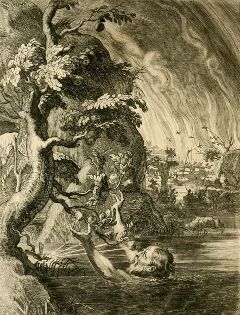
The old seaman’s ditty “water, water everywhere, nor any drop to drink” from The Rime of the Ancient Mariner by Samuel Taylor Coleridge captures the essence of being surrounded by seawater unsuitable for consumption. The word “tantalize” traces its roots to a water-based myth in which Tantalus, a son of Zeus, is punished by the gods by being given great thirst and forced to stand in a pool of water that always recedes out of reach as he leans in to take a drink. The notion of water being just out of reach is now an integral part of the English language, and water's elusiveness inspired many early investments in energy technology. For example, expanding pre-modern societies invested in primitive windmill-powered water pumps and horse-drawn water wells to overcome water scarcity.
A critical underlying aspect to water science is the importance of accurate water bookkeeping. To properly understand the state of water availability and the extent of the water crisis, we must track the flows, uses, and volumes of water in storage in different locations, forms and times of year. Unfortunately, despite many relevant advances in the last century for hydrogeology, these are areas where scientists lag behind. The world’s dataset on water is woefully incomplete, making thoughtful water planning decisions more difficult.1Charles Fishman, “Water Is Broken. Data Can Fix It,” The New York Times, March 17, 2016, accessed June 6, 2016, http://www.nytimes.com/2016/03/17/opinion/the-water-data-drought.html?_r=0. By contrast, energy data are relatively plentiful and available.
Precipitation is one method of water additions, so governments and other organizations monitor it closely. On one hand, meteorologists can easily measure precipitation, but determining how much of that rainfall recharges the underlying aquifers is hard to measure or estimate. In some cases, farmers, families, and hydrologists alike may not know how much water is available until the well runs completely dry.
Installing stream gauges to track flows in rivers, well monitors to estimate the water tables, and pump meters to keep track of withdrawals across watersheds will provide more information about local and global water systems. Even with accurate sensing of surface water, we do not know how much water is in the ground. However, new technologies such as the Gravity Recovery and Climate Experiment (GRACE) give us new eyes in the sky that can see through the ground to reveal the mysteries of groundwater.
This experiment consists of twin satellites launched in 2002.2“GRACE: Gravity Recovery and Climate Experiment,” NASA, last modified July 9, 2014, accessed December 31, 2014, http://www.nasa.gov/mission_pages/Grace/#.V8EAI2VixQc; and T. Green, “The Gravity of Water,” UTNews, October 7, 2011, accessed December 31, 2014, http://www.utexas.edu/features/2011/10/07/grace. The satellites follow each other in their orbit around Earth’s poles. As they orbit, differences in Earth’s mass cause slight differences in the gravity field, which causes the satellites to speed up or slow down in their orbit. While orbiting, the satellites send a microwave beam back and forth between themselves, and they measure how long it takes the beam to travel round-trip. Computers calculate the distance between the satellites, which reveals tiny differences in their relative acceleration. Since acceleration depends on Earth’s mass directly below, the oscillating distance between the satellites provides a highly detailed map of Earth’s gravity field. As they map Earth’s gravity over the years, the satellites paint a detailed view of how Earth’s mass changes with space and time.
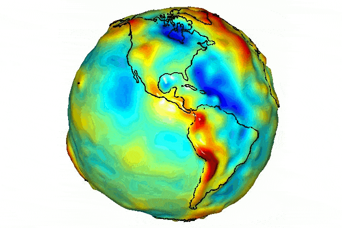
Because Earth’s mass is not uniform and water significantly affects the mass of different regions, GRACE can measure changes in groundwater from space.
Early observations indicate the aquifers in India are emptier and depleting faster than previously believed and the ice sheets in Greenland and Antarctica are melting faster than anticipated.3“GRACE: Gravity Recovery and Climate Experiment,” NASA, last modified July 9, 2014, accessed December 31, 2014, http://www.nasa.gov/mission_pages/Grace/#.V8EAI2VixQc; and T. Green, “The Gravity of Water,” UTNews, October 7, 2011, accessed December 31, 2014, http://www.utexas.edu/features/2011/10/07/grace. GRACE revealed that in northern India, the water table dropped about one foot each year between 2002 and 2008 as farmers withdrew water to irrigate their crops.
The natural capital of groundwater can produce a “natural income” of fresh water for both domestic and agricultural use. Because the sun powers the hydrologic cycle, which returns water to aquifers, groundwater has replenishable natural capital.
Water enters the porous rock of aquifers through a process called recharge. Because geological conditions vary, each aquifer’s recharge rate differs. Similarly, the rate of extraction through pumping differs. Removing water from wells faster than the rate of recharge will eventually deplete the aquifer causing wells to run dry despite the fact that water as a resource connected by a global system is renewable.
For example, some segments of the High Plains Aquifer System, which spans several states, contains water that is millions of years old. Its recharge rate is so slow that water stored in the aquifer is non-renewable.
Source: P.B. McMahon, et al., “A comparison of recharge rates in aquifers of the United States based on groundwater-age data,” Hydrogeology Journal 19 (2011): 779-800, accessed September 28, 2016, doi: 10.1007/s10040-011-0722-5.
Groundwater availability in the United States largely depends on aquifers, geologic formations which contain sufficient saturated permeable material to release water to wells and springs. Hydrologists generally group aquifers into aquifer systems, which can be classified based on their lithology, or the material which makes up the formation. Tap the buttons to select each aquifer.
Image Credits: Sean Nel/Shutterstock.com; NASA/JPL/University of Texas Center for Space Research.
Update your browser to view this website correctly.Update my browser now

