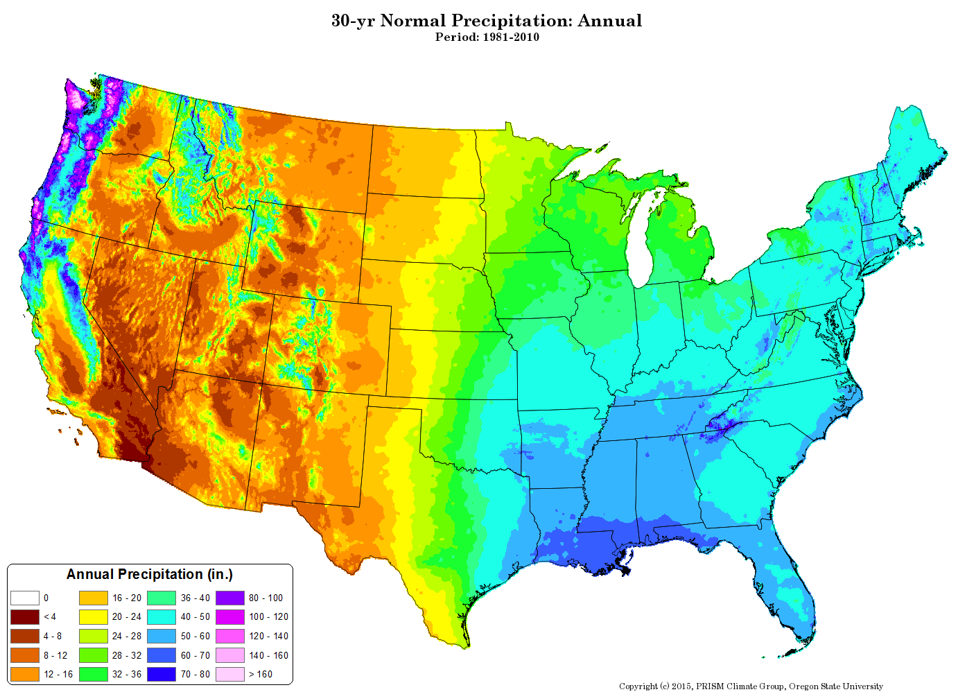
Because rainfall is central to the health of the agricultural sector, the U.S. Department of Agriculture supports nationwide measurement of precipitation and provides world-class data sets to the general public. Rainfall varies from less than 4 inches (100 mm) to greater than 160 inches (4,000 mm) per year within the contiguous United States. Dr. Christopher Daly of Oregon State University synthesized this diversity into the PRISM (Parameter-elevation Regressions on Independent Slopes Model) climate-mapping system. The PRISM model uses measurements of precipitation, temperature, and other climatic factors from all over the nation to create geographically-resolved estimates for monthly, yearly, and event-based climatic parameters such as precipitation.
Geographic and temporal distribution heavily influence the development of global cultures. For example, monsoon rains in Southeast Asia, which bring most of the year’s annual precipitation in a short period of time, drive the rhythms of agriculture and the design of the local communities.
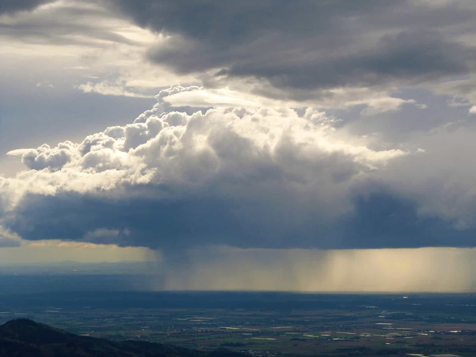
Floods arise from a combination of extreme precipitation and modified ecosystems that cannot accommodate the extra water. At a slow rate, rain can accumulate into lakes and reservoirs, trickle down into aquifers to recharge them, or soak into the soils, grasses, and trees. A healthy ecosystem can absorb precipitation. However, if the rate of rainfall exceeds the rate at which it can be absorbed, or if the ecosystem has been impacted in a way that reduces its ability to absorb water—if parking lots have replaced fields or woods or if paved canals have replaced natural rivers—then a flood is more likely. Floods are one part nature, and one part humanity. By building homes in floodplains, paving over grassy meadows, and bulldozing wetlands, humans diminish nature’s ability to absorb the water when it surges in. Today’s floods have a high propensity to kill, destroy cities, and wipe out infrastructure.
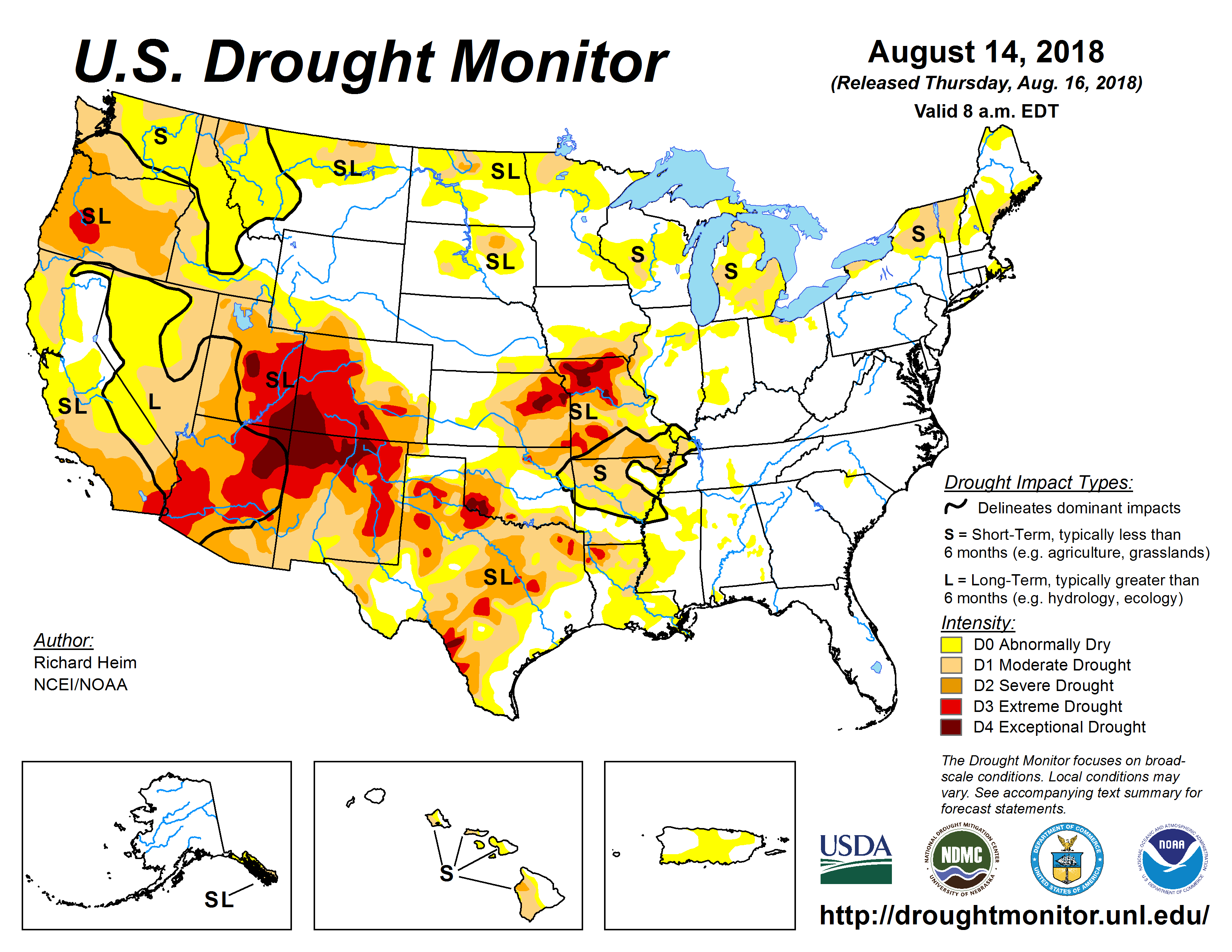
Similar to floods, droughts devastate human systems and incur high recovery costs.1The impact of drought has been covered and reported by multiple sources: John Holland, “Report: Drought drains $2.2 billion from farm economy,” The Modesto Bee, July 15, 2014, accessed December 27, 2014, http://www.modbee.com/news/local/article3167892.html; “Billion-Dollar Weather and Climate Disasters: Table of Events,” National Centers for Environmental Information, U.S. National Oceanic and Atmospheric Administration, accessed August 26, 2016, http://www.ncdc.noaa.gov/billions/events; and Associated Press, “U.S. drought: Half of all counties disaster areas,” CBSNews, August 1, 2012, accessed August 26, 2016, http://www.cbsnews.com/news/us-drought-half-of-all-counties-disaster-areas/. They ruin crops, kill livestock herds, and inhibit recreation such as boating, floating, or fishing. The one-year drought in Texas in 2011 did $7 billion of damage. The drought in California in 2014 caused losses in the agricultural sector exceeding $2 billion and 17,000 jobs. The one-year drought and heat wave in the Midwest United States in 2012 did $30 billion of damage and killed more than 100 people. At its peak, the drought covered a majority of the land area of the United States and caused more than half of all counties to be declared disaster areas. The U.S. government tracks drought and makes the data publicly available through the U.S. Drought Monitor.
All these factors—rainfall, drought, floods—combined with unequal population densities mean that water availability per person is not globally uniform.
Image Credits: jopelka/Shutterstock.com.
Update your browser to view this website correctly.Update my browser now

