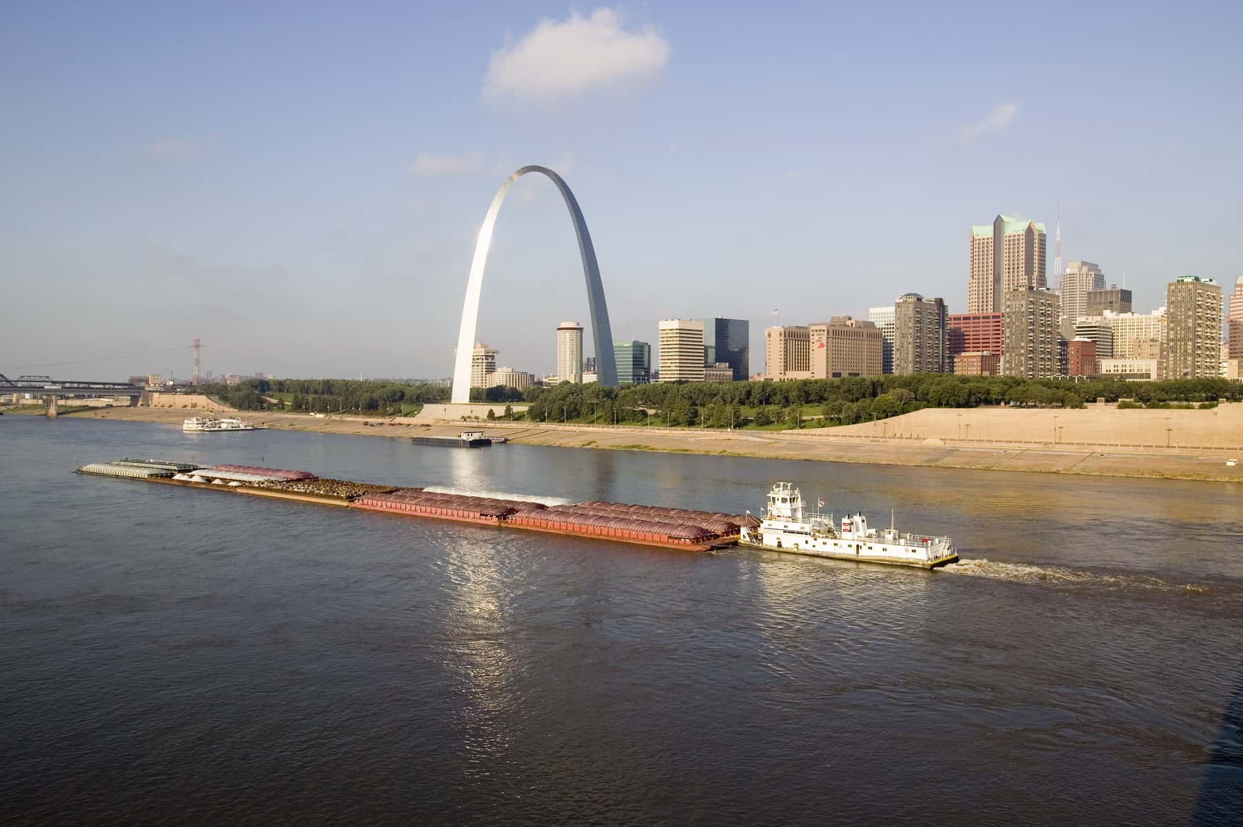
Water projects are closely tied with political systems and power structures. In the nineteenth century, Abraham Lincoln ran on a platform of enhanced water infrastructure—better canals for navigation and commerce.1Doris Kearns Goodwin, Team of Rivals: The Political Genius of Abraham Lincoln (New York: Simon & Schuster, 2005). Water serves an important role for transportation. While railroads are more energy-efficient at moving goods than trucks, cars, or planes, many people do not realize that waterborne commerce is even more energy efficient. In the United States, 18,000 kilometers (km) (11,000 miles) of inland waterways move 725,000 tonne-km (500,000 ton-miles) of freight annually, which is nearly a third of the 2.5 million tonne-km (1.7 million ton-miles) of freight moved by 227,000 km (141,000 miles) of railroads.2Stacy C. Davis, Susan W. Diegel, and Robert G. Boundy, The Transportation Energy Data Book 2012 (Oak Ridge, Tenn.: U.S. Department of Energy Oak Ridge National Laboratory, 2012); and Office of Freight Management and Operations, Freight Facts and Figures 2011 (Washington: U.S. Department of Transportation Federal Highway Administration, 2011). In particular, the lower Mississippi River and its famous barges move a lot of cargo.
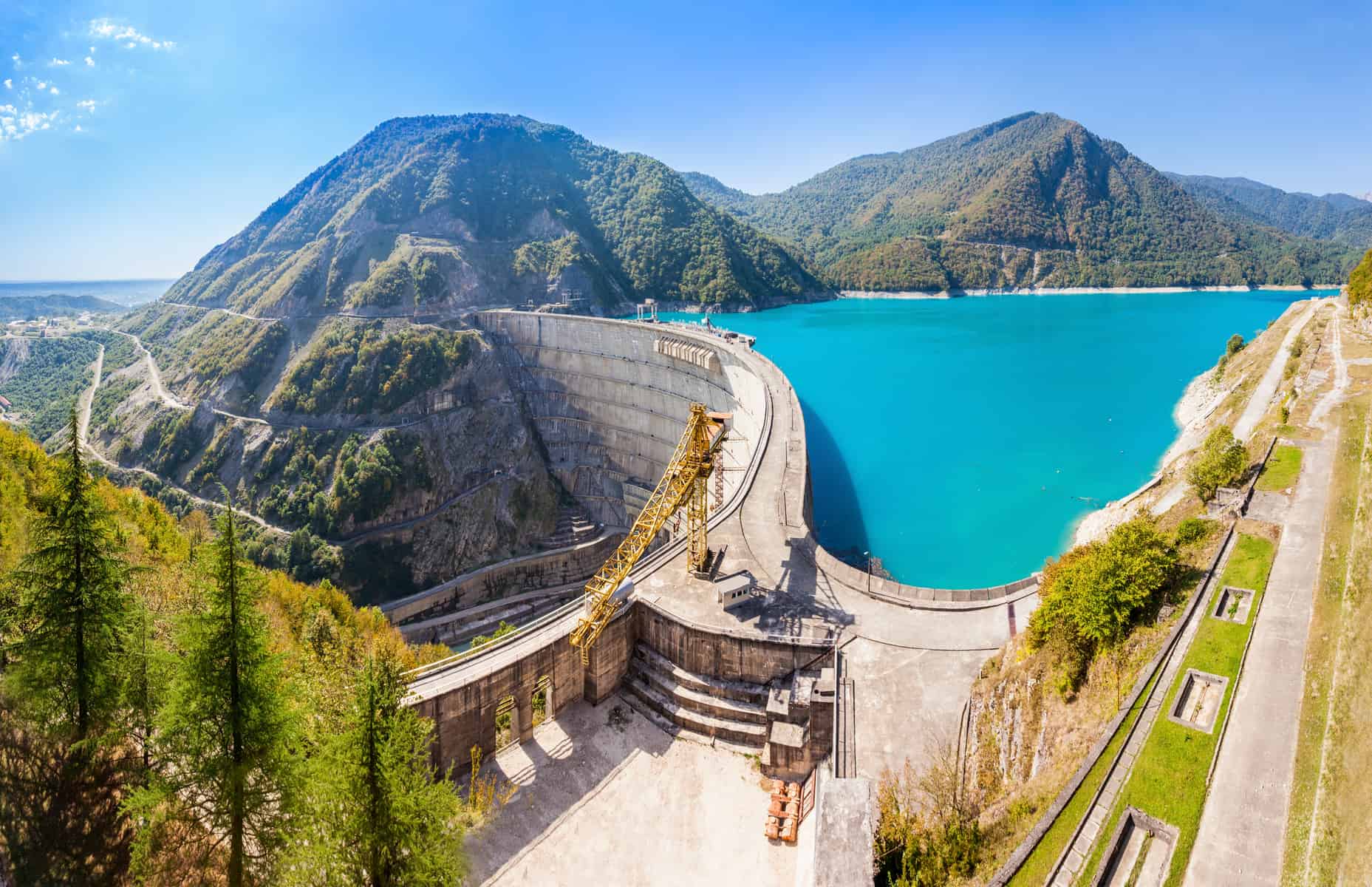
Decades after Lincoln, the federal government built and named the largest dam in the world for President Herbert Hoover. Before the Hoover Dam, the very first hydroelectric dams had not been very large in size. They more closely resembled medieval overshot water wheels that were used for mechanical power to grind grain, cut wood, or polish glass. For these older wheels, the flowing water of the river rotated a massive wooden wheel that was connected by wooden gears and axles to a workhouse on the bank of the river. Reservoirs maxed out around 3 meters (10 feet) high, and these structures were not considered to be that impactful to the river’s natural flow.
The ecological damage of dams and their massive reservoirs is hard to assess. While dams make electricity relatively cleanly, they distort the landscape with a permanent mark. Fish and other animals cannot freely travel the rivers once dams are put in place. Famously, salmon fight currents to go upstream many hundreds of miles, jumping over obstacles along the way to spawn. While they can impressively jump over small rapids a few feet tall, they cannot jump over dams. Consequently, some dams have installed “fish ladders” that are a cascading series of waterfall steps that allow salmon to bypass the dam. Even if they successfully navigate the fish ladder, their navigational systems, which benefit from a distinct current in the water, can get confused by the slack water on the other side of the dam. Fish also get caught going downstream. The whirling blades of the hydroelectric turbines have been known to harm the fish while they pass through. More recently, with the advent of “fish-friendly’’ turbines, fish can pass through with less likelihood of being injured.
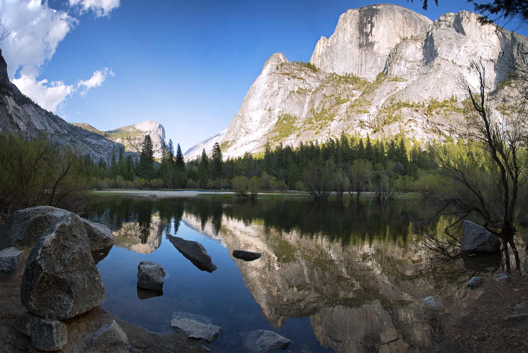
Silting is another major problem for dams. Sometimes silt is needed downstream because its minerals are useful for agriculture. Dams stop the flow of silt, causing it to accumulate behind the concrete walls. Eventually, the silt will fill up the reservoir, causing the dam to lose its function. This phenomenon happens for natural dams and lakes. In Yosemite Valley, receding glaciers left a natural dam of rocks and rubble that caused water to pool up, forming Mirror Lake. Over millennia, silt has been filling the natural lake, so it is now more of a pond than a lake and is only filled in the spring when the water levels are high. Eventually it will disappear altogether.
Dams can negatively impact river temperatures in substantial ways.3A. Lugg and C. Copeland, “Review of cold water pollution in the Murray–Darling Basin and the impacts on fish communities,” Ecological Management & Restoration 15 (2014): 71–79; and Daniel B. Hayes, Hope Dodd, and JoAnna Lessard, “Effects of Small Dams on Cold Water Stream Fish Communities,” American Fisheries Society Symposium 2006, 587-602. Usually temperatures are relatively uniform for a free-flowing river. After a reservoir is built, the temperature can vary significantly from the water surface (relatively warm) to the bottom of the water column (relatively cold). Water flowing through the dam from the bottom of the reservoir can lower the temperature of the river downstream. Native river species are often not adapted to the cooler water. In some cold environments with surface-release dams, the opposite can happen: dams release water downstream from the relatively warmer surface, making downstream temperatures slightly higher than they would have been otherwise. Both situations can affect fish reproduction. Consequently, native river species must often migrate upstream of the dam to reach normal conditions or move downstream until temperatures stabilize.
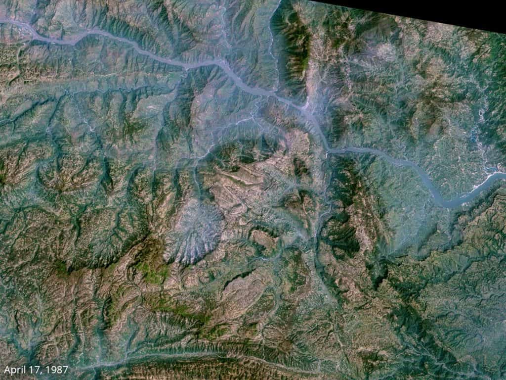
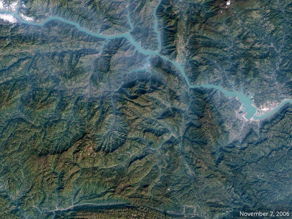
NASA image created by Jesse Allen, using Landsat data provided by the University of Maryland’s Global Land Cover Facility.
Swipe left or right to compare the Yangtze River in the vicinity of the Three Gorges Dam (middle right). Landsat 5 acquired the “before” image on April 17, 1987. Landsat 7 acquired the “after” image on November 7, 2006, after the main wall was complete.
Chinese leaders sought the Three Gorges Dam for decades and finally saw construction in the 2000s. While it has helped reduce the risks of flood-related disasters and improved the navigability of the Yangtze River, its creation flooded entire valleys, displacing people and erasing towns.4Xiankun Yang and X X Lu, “Ten years of the Three Gorges Dam: a call for policy overhaul,” Environmental Research Letters 8 (2013), accessed August 26, 2016, doi:10.1088/1748-9326/8/4/041006. Geologists worry about the earthquakes and underwater landslides caused as the soft, soaked soils around the reservoir settle to accommodate the new load. In the first decade of its operation, the reservoir, which is as long as Great Britain, triggered more than 500 earthquakes with a magnitude greater than 2.0 on the Richter scale and more than 400 landslides. If the Three Gorges Dam were to collapse, it would put approximately 15 million or more lives at risk downstream. In the event of a collapse, the biggest man-made wall of water ever conceived would move quickly down the canyons, making it difficult for people to escape.
The 1889 Johnstown Flood, triggered by a collapsed dam, killed more than 2,200 people in Pennsylvania. The Saint Francis Dam collapse in Santa Clarita, California, in 1928 killed 600 people and still reverberates through Southern California water politics. The collapse of the Grand Teton Dam along the Teton River in eastern Idaho in 1976 was caught on film, and it shows the powerful force of the water. Thankfully, its collapse was in the middle of the day, so only 11 people were killed. The wall of water wiped out two small towns and so if the flood had occurred in the middle of the night, it is likely that thousands of people would have perished.
Image Credits: saiko3p/Shutterstock.com; Joseph Sohm/Shutterstock.com; Jane Rix/Shutterstock.com.
Update your browser to view this website correctly.Update my browser now

